 \
\
\
What is A Blizzard?
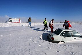
A blizzard is a severe storm condition characterized by low temperatures, strong winds, and heavy snow. Many blizzards are in the Canadian region. By definition, the difference between blizzard and a snowstorm is the strength of the wind. Ground blizzards are a variation on the traditional blizzard, in that ground blizzards require high winds to stir up snow that has already fallen, rather than fresh snowfall. Regardless of the variety of blizzard, they can bring near-whiteout conditions, which restrict visibility to near zero. Blizzards have a negative impact on local economies and for days at a time can paralyze regions where snowfall is unusual or rare
Blizzard Characteristics
Blizzards are characterized by low temperatures (usually below 20°F) and
accompanied by winds that are at least 35 mph or greater, there must also be
sufficient falling and/or
blowing snow in the air that will frequently reduce visibility to 1/4 mile or less for a duration of at least 3 hours.
A severe blizzard is considered to have temperatures near or below 10°F, winds exceeding 45 mph, and visibility reduced by snow to near zero.
Blizzard conditions often develop on the northwest side of an intense storm system The difference between the lower pressure in the storm and the higher pressure to the west creates a tight pressure gradient
which in turn results in very strong winds.
These winds combine with snow and blowing snow to produce extreme conditions. Storm systems powerful enough to cause blizzards usually form when the
jet stream dips far to the south, allowing cold air from the north to clash with warm air from the south.
With the colder and drier polar air comes atmospheric temperatures cold enough for the development of snow, sleet, or freezing rain.
The Dakotas and parts of Minnesota were pounded by a succession of blizzards in the winter of 1996-1997. With few trees or other obstructions to reduce wind
and blowing snow this part of the country is particularly vulnerable to blizzards.
A continuation of the broad central plains that run from the Gulf of Mexico into Canada, this area often experiences severe blizzard conditions, with wind chills of 40°F below or more and whiteout conditions.
Another scenario occurs when a cold core low over the Hudson Bay area is displaced southward over southeastern Canada, the Great Lakes, and New England. As rapidly moving short waves
or areas of upward vertical motion and energy, move around the low, they collide with warmer air coming north from the Gulf of Mexico. This produces strong surface winds, lots of cold air advection, and extensive wintry precipitation.
In the southern central Great Plains, rapidly intensifying low pressure systems moving out of the Rocky Mountains can cause heavy snows and strong winds to the north, while to the south and east are thunderstorms and rain.
When cold, moist air from the Pacific Ocean makes it over the Rockies and into the Plains and warmer, moist air moves north from the Gulf of Mexico, all that is needed is a cold closed
low aloft and a strong polar jet for potential blizzard conditions that may extend from the panhandle of Texas to the Great Lakes.