|
Satellite Images
>> Visible: Senses reflected visible
light
|
|
|
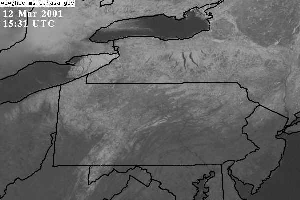
Figure 1: This image shows a
basic visible satellite loop over Pennsylvania. The satellite obtained
this loop by recording the amount of visible light reflected from the
surface features and clouds. |
Visible satellite images are very useful tools that allow meteorologists to
view various atmospheric features through the use of reflected visible light.
Since these satellite sensors use reflected visible light in order to produce their
images, visible satellite images can best be used during the daytime when solar
radiation is reflected back toward the satellite. A visible satellite loop
can be seen in Figure 1 to the right.
In addition to sensing reflected
visible light, these satellites can also determine cloud thickness by figuring
out how much visible light a cloud reflects, or its albedo. A thicker
cloud generally has a higher albedo, and therefore, reflects more light.
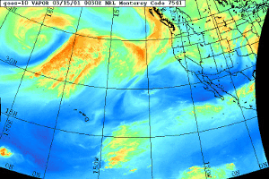
>> Infrared: Senses terrestrial radiation emitted through the atmospheric window
Infrared satellite sensors, instead
of detecting reflected solar radiation from the surface of the Earth, rely on
the detection of terrestrial radiation emitted through the atmospheric window.
Since terrestrial radiation is constantly being emitted from the surface and from
atmospheric features, infrared satellite images can be used 24 hours a day. An
infrared satellite loop can be seen in Figure 2 below.
|
|
|
Figure 2: An infrared satellite loop.
This image shows terrestrial radiation emitted through the
atmospheric window. |
|
|
|
Figure 3:
The image above illustrates the relation between cloud top temperature and
height. |
Infrared satellite images can also be used to calculate the temperature, and therefore
height, of cloud tops. This is done through the use of the Stefan-Boltzmann
Law, which relates the amount of radiation emitted by a body and its
temperature. This process is illustrated in Figure 3 to the left.
>> Water Vapor: Senses infrared
radiation absorbed/emitted (Kirchoff's Law) by water vapor.
|
|
|
Figure 4:
A water vapor image. This satellite image
shows the movement of water vapor in the atmosphere by detecting 6.7 micron
radiation emitted by the vapor. |
Water vapor satellite images are obtained
by the detection of radiation emitted at 6.7 microns in wavelength - the primary
wavelength at which water vapor absorbs and emits radiation. Since water
vapor is always present in the atmosphere, water vapor satellite images allow
meteorologists to see large scale atmospheric motions even when there are no
clouds present. An example of a water vapor satellite loop can be found to
the right in Figure 4.
Absorptivity: Transparent versus Opaque
>> See
Lecture Two Outline for details
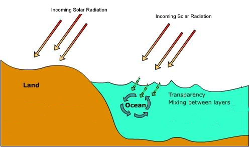
Distribution of Solar Radiation
>> The sun warms the ground and the
ground warms the air!
The incoming solar radiation warms
the ground, which in turn warms the air through conduction and convection.
Conduction is the process by which heat energy is transferred through direct
contact. This process can be seen below in Figure 5. Convection, on
the other hand, is the transfer of heat energy due differential heating of a
substance. To view a movie demonstrating convection,
click here (you
must have the Quicktime plug-in to view this movie).
|
|
|
Figure 5:
The application above demonstrates the process of conduction. In order
to see how heat is transferred through direct contact, click the Flame On!
button. |
Annual Cycle: Tilt of the Earth's Axis
>> See
Lecture Two Outline for details
Seasonal Temperature Lag: Heat Capacity
>> It takes time for land
temperature to respond to solar radiation
>> Water is slower to warm than land
|
 |
|
Figure 6:
The image above shows the difference in the absorption of incoming solar
radiation by water and land. |
It takes much more solar radiation to
warm one kilogram of water than it does to warm the same amount of land.
In addition, solar radiation can penetrate further into
water than it can into land, effectively spreading the heating through a much larger vloume. Also, the solar radiation that is absorbed by
the ocean can easily be mixed by ocean currents and waves.
Figure 6, to the left, illustrates the differences between the absorption of
solar radiation by land and water.
|